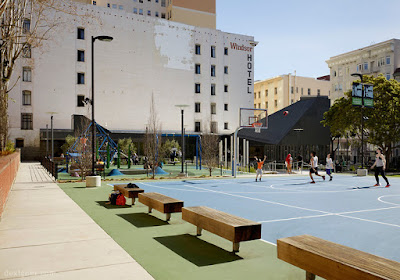
Walkability, Economics and the State of Place Index
From a human wellbeing perspective the benefits of walkability have become common knowledge. Walkable neighborhoods produce lower rates of obesity and associated chronic diseases as well as environmental benefits of reduced emissions of greenhouse gases, and improved sustainability and resilience. Now real estate developers have begun to understand these implications and have pushed walkability into the forefront of real estate developments. This is because now 80% of 18-24 year olds want to live in walkable neighborhoods. An AARP survey found that an average of 60% of those over 50 want to live within a mile of daily goods and services. In 13 of 15 major U.S. markets, an increase of one point in Walk Score ( a way of measuring walkability to commercial destinations on a scale of one to 100) translated into home price premiums of between $700 and $3000.In New York the city’s Department of Transportation found the following:
- a series of pedestrian and bicycle infrastructure projects translated into significant returns on investment, with protected bike lanes tied to a 49 percent increase in retail sales, compared with 3 percent boroughwide;
- small expansions of pedestrian rights-of-way were tied to a 49 percent reduction in commercial vacancies, compared with 5 percent citywide;
- transformation of an underused parking area translated into a 172 percent increase in retail sales at local businesses over three years; and
- conversion of a curb lane into outdoor seating increasing pedestrian numbers by more than 75 percent and increased sales at bordering businesses by 14 percent.
Another finding is that mixed use downtown development generates ten times the tax revenue per acre than does sprawl development. It also saves 38 percent on upfront infrastructure costs per unit, and saves 10% on ongoing services delivery.
Maria Alfonzo, who talks about these benefits in her article for the Urban Land Institute has pioneered a new tool she calls the State of Place Index that aims to quantify the economic benefits of Walkability.
Using Houston as an example in the article, the index showed a potential increase in retail sales and tax dollars from improvements for walkability. The index works like this- Firstly neighborhoods are classified within a region according to the types of interventions and investments needed in terms of walkability. Secondly, priorities are set within a neighborhood itself, and types of walkability interventions are indentified, eg, pedestrian amenities, traffic safety, parks and public spaces. These are ranked as to which will give cities and investors the biggest impact for the least cost.
Finally, specific interventions and/or development projects are identified that would have the biggest impact on the State of Place Index. A predicted return on investment is calculated. This tool goes someway to identifying winning strategies that any city can begin to implement and gives a framework in which cities can start to understand where in their own neighborhoods walkability interventions/investments can be made successfully.
https://urbanland.uli.org/sustainability/houston-economic-case-walkability/
All images and text are found at uli.org
Stateofplace.org
https://urbanland.uli.org/sustainability/houston-economic-case-walkability/
All images and text are found at uli.org
Stateofplace.org


